-17.693,16.613,342.6,1.1,1.1,2020-12-12,1230,Aqua,85,6.0NRT,320,28.5
-17.804,16.433,333.3,1.1,1.1,2020-12-12,1230,Aqua,69,6.0NRT,319.6,12.1
-18.486,17.684,357.5,1,1,2020-12-12,1230,Aqua,98,6.0NRT,321.8,56.7
-18.485,17.694,364.3,1,1,2020-12-12,1230,Aqua,100,6.0NRT,321.1,74.7
-18.48,17.734,346.7,1,1,2020-12-12,1230,Aqua,55,6.0NRT,323,25.1
-18.494,17.696,362,1,1,2020-12-12,1230,Aqua,88,6.0NRT,327.9,63
-18.493,17.706,373.9,1,1,2020-12-12,1230,Aqua,100,6.0NRT,324.4,100.9
-18.511,17.638,373.6,1,1,2020-12-12,1230,Aqua,100,6.0NRT,319.8,108.6
-18.505,17.687,365,1,1,2020-12-12,1230,Aqua,100,6.0NRT,326.3,70.8
-18.502,17.707,382.5,1,1,2020-12-12,1230,Aqua,100,6.0NRT,332.4,133.2
-18.501,17.717,368.3,1,1,2020-12-12,1230,Aqua,100,6.0NRT,326.3,75.6
-18.521,17.639,380.3,1,1,2020-12-12,1230,Aqua,100,6.0NRT,327.6,133.9
-18.519,17.649,360.9,1,1,2020-12-12,1230,Aqua,100,6.0NRT,328.6,62.7
-18.514,17.689,352.8,1,1,2020-12-12,1230,Aqua,86,6.0NRT,326.1,36.6
-18.528,17.651,351,1,1,2020-12-12,1230,Aqua,92,6.0NRT,326.3,35.2
-18.527,17.66,347.4,1,1,2020-12-12,1230,Aqua,78,6.0NRT,328.2,25.5
-18.536,17.732,347.9,1,1,2020-12-12,1230,Aqua,74,6.0NRT,328.3,24.7
-18.545,17.734,345.6,1,1,2020-12-12,1230,Aqua,56,6.0NRT,326.4,20.2
-18.802,17.599,340.8,1.1,1,2020-12-12,1230,Aqua,79,6.0NRT,321.4,18.6
-18.801,17.609,361,1.1,1,2020-12-12,1230,Aqua,100,6.0NRT,324.7,65.3
-18.81,17.611,347,1.1,1,2020-12-12,1230,Aqua,87,6.0NRT,323.6,29.3
-18.808,17.621,352,1.1,1,2020-12-12,1230,Aqua,94,6.0NRT,325.5,39.8
-18.918,19.004,335.6,1,1,2020-12-12,1230,Aqua,72,6.0NRT,313.1,12.2
-18.917,19.013,336.3,1,1,2020-12-12,1230,Aqua,74,6.0NRT,313.7,13.2
-18.924,19.03,339.7,1,1,2020-12-12,1230,Aqua,80,6.0NRT,316.2,16.7
-19.151,17.869,334.2,1,1,2020-12-12,1230,Aqua,25,6.0NRT,319.2,9.7
-19.15,17.879,338.2,1,1,2020-12-12,1230,Aqua,77,6.0NRT,323.2,17
-19.148,17.889,337.2,1,1,2020-12-12,1230,Aqua,61,6.0NRT,321.1,14.9
-19.159,17.881,343.6,1,1,2020-12-12,1230,Aqua,81,6.0NRT,321.5,27
-19.271,18.13,340.3,1,1,2020-12-12,1230,Aqua,80,6.0NRT,321.4,23
-19.269,18.14,333.1,1,1,2020-12-12,1230,Aqua,61,6.0NRT,318.7,11.4
-18.508,17.714,338.1,3.2,1.7,2020-12-12,0940,Terra,83,6.0NRT,310.4,123.8
-18.027,14.695,329.2,1.9,1.3,2020-12-12,0940,Terra,44,6.0NRT,313.1,19.5
-18.75,17.692,305,1,1,2020-12-12,0015,Aqua,25,6.0NRT,292.9,5.5
-18.74,17.679,309.8,1,1,2020-12-12,0015,Aqua,51,6.0NRT,293.3,8.5
-18.499,17.738,300.4,1,1,2020-12-12,0015,Aqua,27,6.0NRT,289.7,4.6
-17.798,16.445,315.7,1,1,2020-12-12,0015,Aqua,92,6.0NRT,292.3,14.8
-17.797,16.436,311.6,1,1,2020-12-12,0015,Aqua,83,6.0NRT,291.8,11.5
-17.682,16.527,303.6,1,1,2020-12-12,0015,Aqua,48,6.0NRT,289.7,6.3
-17.686,16.613,304,1,1,2020-12-12,0015,Aqua,58,6.0NRT,291.4,6.7
-17.678,16.557,301.5,1,1,2020-12-12,0015,Aqua,39,6.0NRT,288.9,5.4
| NASA FIRMS: Fire Email Alert 41 fires/hotspots detected in your area-of-interest in the past 24 hours | |||||
| (Country: Namibia)
View map image on NASA FIRMS server NOTE: Cloud cover might obscure active fire detections. This email was generated on 2020-12-13 10:54:40 UTC NASA FIRMS Data Source: MODIS Collection 6 NRT | |||||
| |||||
|
|


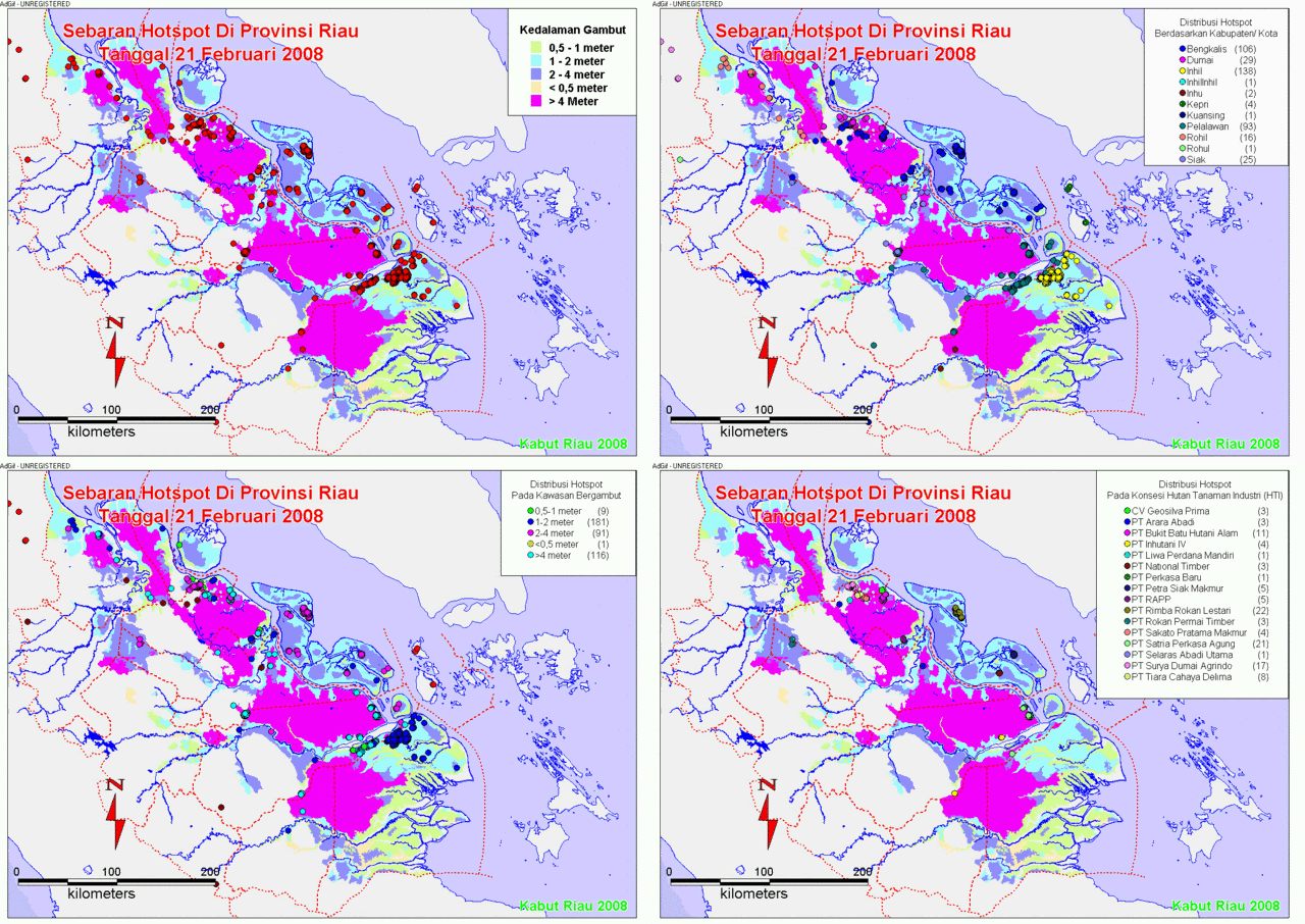
![[Hotspot+February+Kumulatif.gif]](https://blogger.googleusercontent.com/img/b/R29vZ2xl/AVvXsEiE7noWgaqECLYtKeyNcu29bQGBKqd60aooasO9ZTXF-Ct9aIChNGSyKfrGxdhiswsZRrQLoypOsXpVL6BtfYpk6gDW6XJhL3-MBcHatIAHhqTebu951v8GhuJvXCgtyBqlXAXuR3vnd7n6/s1600/Hotspot+February+Kumulatif.gif)


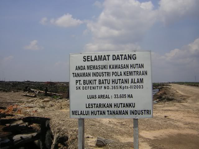
![[hotspot+9-22+mei+08.gif]](https://blogger.googleusercontent.com/img/b/R29vZ2xl/AVvXsEimOA7wvCSbPdM0vgcMWqQKECcTT3zuTOWy75Pox0ANE2UEBHsgTQ-WgltyNRaquBjvQ_DTuv1JJbqL19EtgXrNyteRwPLMmNCVb96wX5hyphenhyphengOSv31gpU4Bh4_vfz6cNdVc6ta8IEMick9Ce/s1600/hotspot+9-22+mei+08.gif)
Tidak ada komentar:
Posting Komentar