-17.39585,15.89326,335.2,0.39,0.36,2021-01-14,1230,NOAA-20,low,2.0NRT,308,2.7
-17.49344,16.31639,343.7,0.39,0.36,2021-01-14,1230,NOAA-20,nominal,2.0NRT,306.6,3.4
-17.75854,16.35476,337.2,0.39,0.36,2021-01-14,1230,NOAA-20,nominal,2.0NRT,305.6,3.1
-17.91821,16.41679,339,0.39,0.36,2021-01-14,1230,NOAA-20,nominal,2.0NRT,302.6,3.7
-18.63544,12.76179,332.7,0.45,0.39,2021-01-14,1230,NOAA-20,low,2.0NRT,300,2
-18.11221,16.58618,338.1,0.39,0.36,2021-01-14,1230,NOAA-20,nominal,2.0NRT,305.2,3.6
| NASA FIRMS: Fire Email Alert 6 fires/hotspots detected in your area-of-interest in the past 24 hours | |||||
| (Country: Namibia)
View map image on NASA FIRMS server NOTE: Cloud cover might obscure active fire detections. This email was generated on 2021-01-15 10:51:32 UTC NASA FIRMS Data Source: VIIRS 375m NOAA-20 | |||||
| |||||
|
|


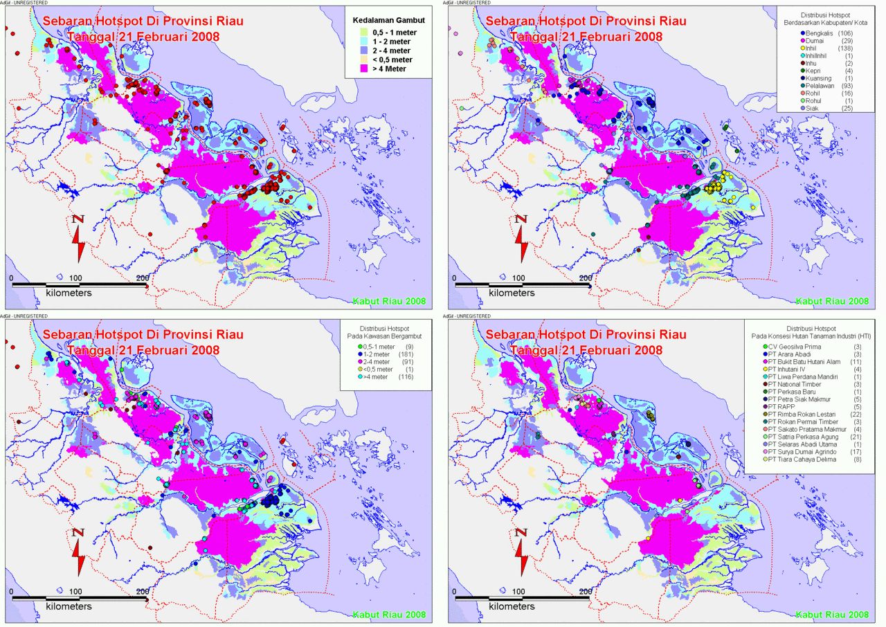
![[Hotspot+February+Kumulatif.gif]](https://blogger.googleusercontent.com/img/b/R29vZ2xl/AVvXsEiE7noWgaqECLYtKeyNcu29bQGBKqd60aooasO9ZTXF-Ct9aIChNGSyKfrGxdhiswsZRrQLoypOsXpVL6BtfYpk6gDW6XJhL3-MBcHatIAHhqTebu951v8GhuJvXCgtyBqlXAXuR3vnd7n6/s1600/Hotspot+February+Kumulatif.gif)


![[hotspot+9-22+mei+08.gif]](https://blogger.googleusercontent.com/img/b/R29vZ2xl/AVvXsEimOA7wvCSbPdM0vgcMWqQKECcTT3zuTOWy75Pox0ANE2UEBHsgTQ-WgltyNRaquBjvQ_DTuv1JJbqL19EtgXrNyteRwPLMmNCVb96wX5hyphenhyphengOSv31gpU4Bh4_vfz6cNdVc6ta8IEMick9Ce/s1600/hotspot+9-22+mei+08.gif)
Tidak ada komentar:
Posting Komentar